Little Colorado River
Category : Blog , Dr. Collard's Adventures
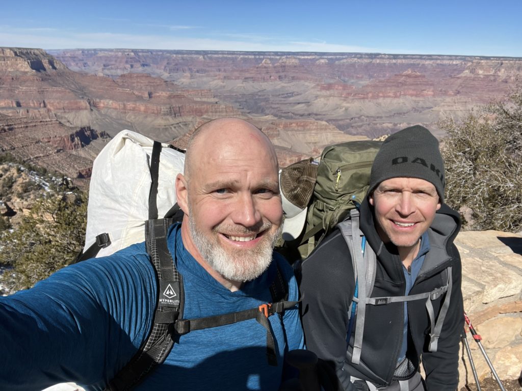
At the end of February, I was able to hike down to the LCR (Little Colorado River) and catch a glimpse of the famous blue waters with my hiking friend and fellow doc from Cedar City. After taking one car to Grandview trailhead where we will be exiting, we drove the 93 miles to the Salt Creek Trailhead. We started about 12:30, way behind schedule due to the snow on the roads from the storm that passed through the day before. It was 3 miles to the river and a loss of 3,000 feet. We came across the first of the two “War Twins” that mark the way to the salt mines.

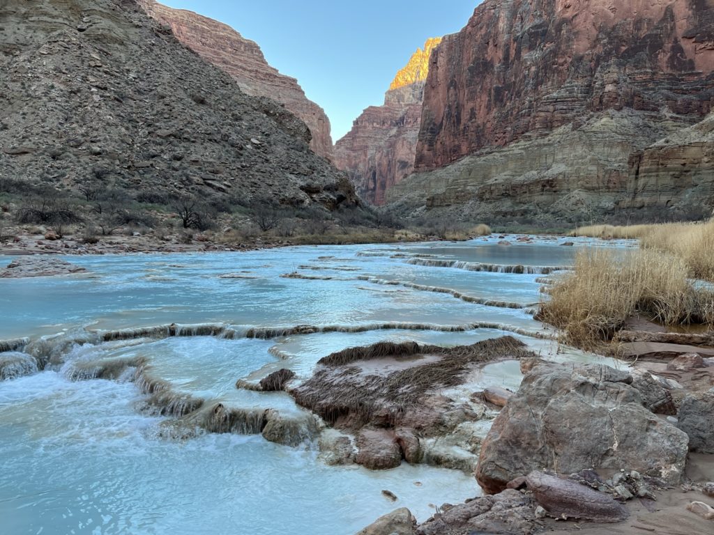
Here is the video of when we reached the LCR and saw the blue turquoise water.
We needed to cross the river and get to the other side but we crossed at the wrong spot and had to bushwhack an hour before we found the right trail. We were behind so we only were able to go 7.5 miles on the first day which meant we had to add 2.5 miles to our day two which was already 12.2 miles.
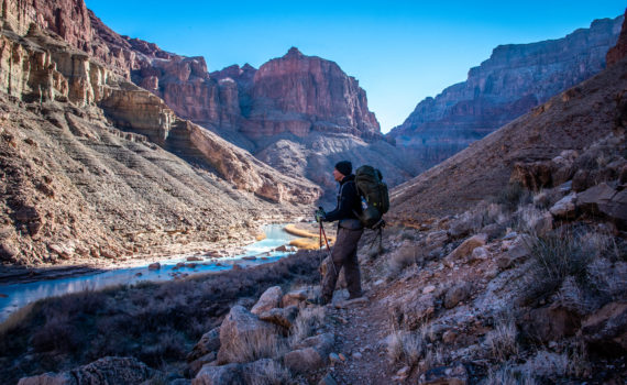
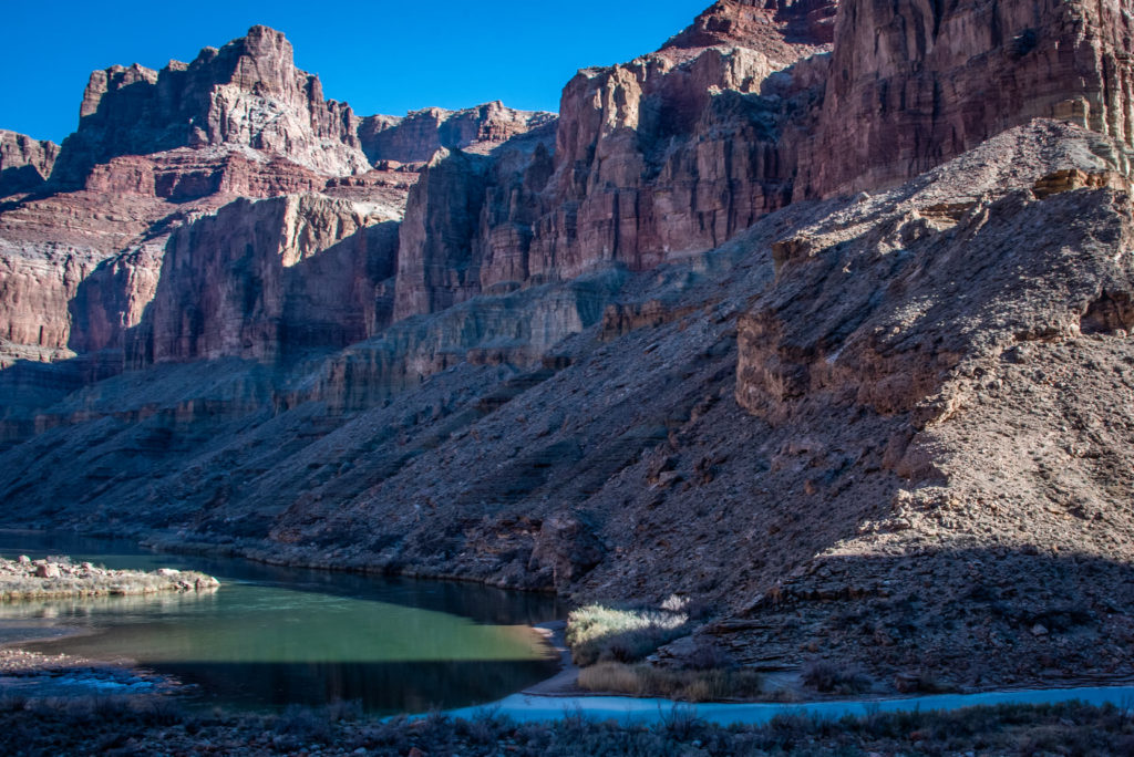
Day 2: We started off just a few miles from the confluence and hit the confluence of the LCR to the Colorado River (mile 62) around 9:30 in the morning. Since we were behind we weren’t able to stay longer and we didn’t get a good picture of the turquoise water mixing with the green water of the Colorado River.
https://www.facebook.com/ryan.emmett.33
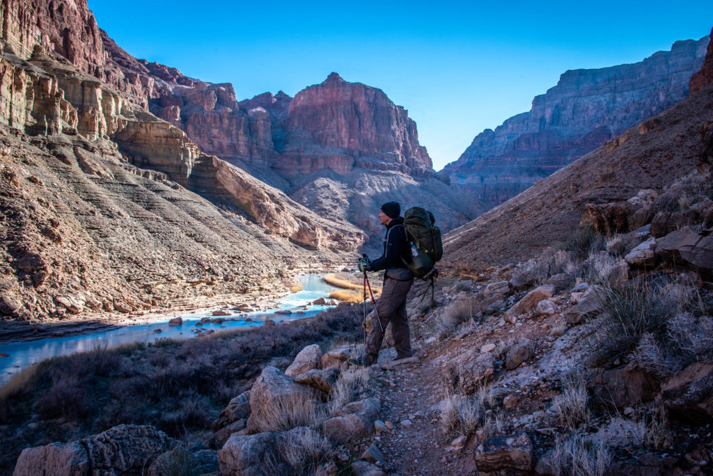
Photo Credit: @dremmettdc
https://www.facebook.com/ryan.emmett.33
The Beamer trail starts at the confluence and we followed that along the Colorado River. It is a narrow trail at times that one misstep could plunge you hundreds of feet down to the river. Even though we are hiking along the river there is no access to water due to the cliffs that prevents us from getting to it. After about 9 miles from the confluence, we rested at Tanner Beach. This is also where the Beamer Trail ends and the Escalante route starts. We then go another 3 miles and end for the day at Cardenas Creek where we camp for the night. This brought our total miles for the day to 14 and 22 miles total.
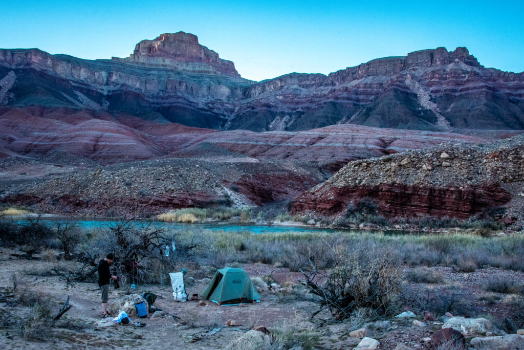
Photo Credit: @dremmettdc
https://www.facebook.com/ryan.emmett.33
Day 3: We got up early and started our long day. We climbed up to go around Unkar Creek Rapids (mile 73) and find ourselves up at “Butchart’s Notch” that looks down into the drainage of Escalante Creek. You can see Unkar rapids on the East end and pan around looking down river and see Neville Rapids and Hance Rapids just beyond.
The trail drops back down to the river following the Escalante drainage and then back up to Seventy-Five Mile canyon and drainage. Seventy Five mile canyon slot canyon was a highlight of our day.
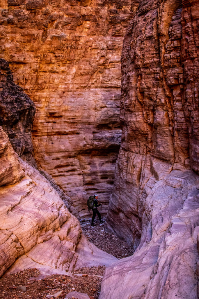
Photo Credit: @dremmettdc
https://www.facebook.com/ryan.emmett.33
A little further down past Seventy Five mile drainage we come upon Papago Creek. This is where we find out why it is called a route and not a trail. We had to scale a 30-40 foot cliff with our 40 lbs. packs on our backs to go up and over the cliffs that jut out into the river making it impossible to go around. It was a little nerve racking but we were cautious and made it safely where we scrabbled down the other side back to the river. I felt very vulnerable and was extremely glad to finish that section. We ended up at Hance Rapids (mile 77) and sat and ate lunch. This was the same camp spot where we spent the last night the previous year on our 90 mile trip down the Colorado in our pack rafts. We had already traveled 9.5 miles but still had a little over 5 more to go with 1200 fee of elevation gain. At Hance Rapids the Escalante Route ends and we pick up the Tonto East Trail. We finished our day at Hance Creek just as it was getting dark and set up for our last night in the canyon.
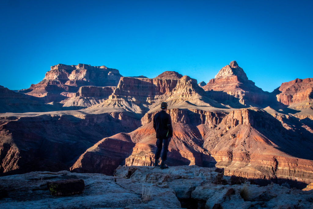
Photo Credit: @dremmettdc
https://www.facebook.com/ryan.emmett.33
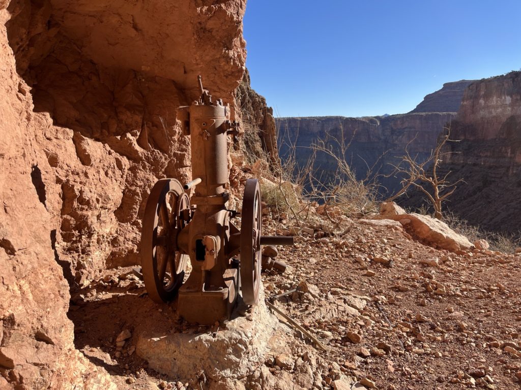
Day 4 This morning at Hance Creek was colder due to the elevation but since my friend Ryan brought a tent, we stayed warm that night. We only had about 5 miles to hike out but we had to gain about 3,600 feet in elevation. We passed an old mine and those early miners had to be as tough as nails. You can still see some old mining equipment and I’m in awe at the weight that had to be carried down by man or some unlucky mule.
At Horseshoe Mesa we picked up the Grandview Trail which will take us out of the canyon. For the last 1.5 miles, we were hiking in snow due to the recent storm that passed through the night before we started. We started at the trailhead at Hopi Salt Trail to the Beamer and then along the Escalante to the Tonto and then up Grandview for a total of 42 miles. The Grand Canyon is an unforgiving and hostile place and that is what draws me to it. Thank you Ryan for the planning and itinerary. I can’t wait for our next adventure.
Back to our home page click here.
Follow us on youtube